Informed decision-making relies on the integration of seismic data and interpreter knowledge. Interpreters’ insight is crucial to optimise areas of high geologic potential.
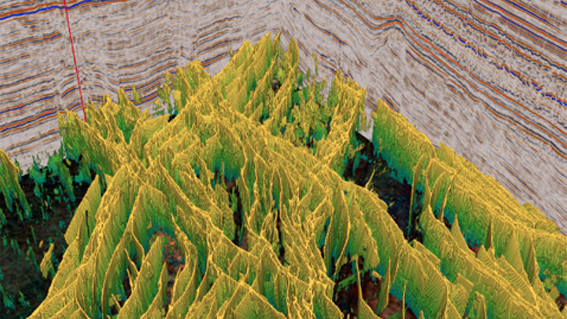
The Canning Basin has undergone several phases of tectonic deformation, which has led to it becoming a complex structural setting, difficult to understand. It’s crucial to understand the regional structure and implications of such on the hydrocarbon system.
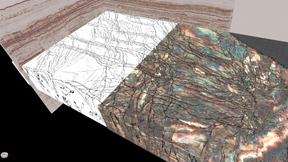
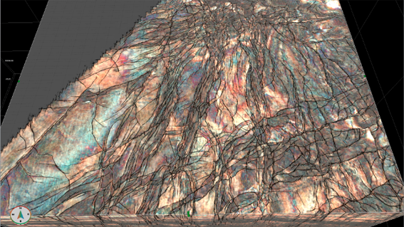
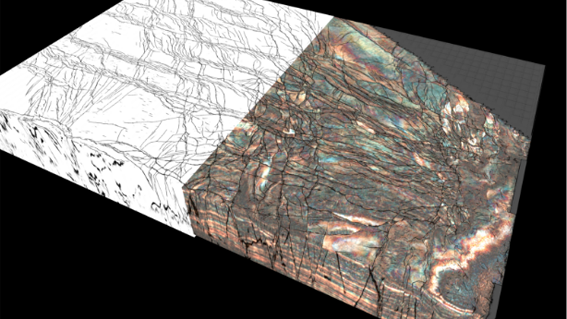
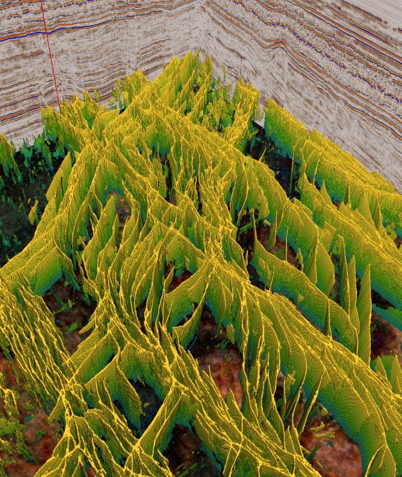
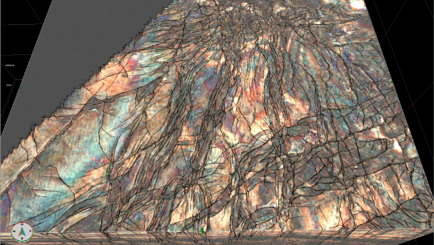
Using the existing Canning TQ3D dataset, we applied Geoteric’s AI Fault Interpretation Service to deliver a detailed understanding of the reservoir to a degree that has never been possible before.
We wanted a deeper understanding of the regional structural trends, helping to indicate the timing of rifting events and the formation of suitable structural hydrocarbon traps. We also wanted to understand if there were any specific compartmentalised fault blocks which may highlight potential prospects, or conversely any areas that looked like they may seal, but in detail do not. Much better to understand the system before using the drill bit.
As a result of our AI Fault Interpretation, we were quickly able to provide extremely high-quality structural understanding of a 100GB dataset. Faults of all scales were imaged and detected within a day, and the level of detail and clarity achieved by our AI results exceeded what was previously possible with conventional seismic attributes.
Read our case study to learn how our cutting-edge AI technology is enabling a revolution in subsurface understanding of your reservoirs and take an in-depth look at AI integration in the seismic interpretation workflow.
Project Imagery
Image Title
Image Title
Image Title
Title
image title
“I was initially very sceptical about the AI approach; however, the results have drastically exceeded my expectations. I am confident it is going to revolutionise the seismic fault delineation and interpretation workflow”