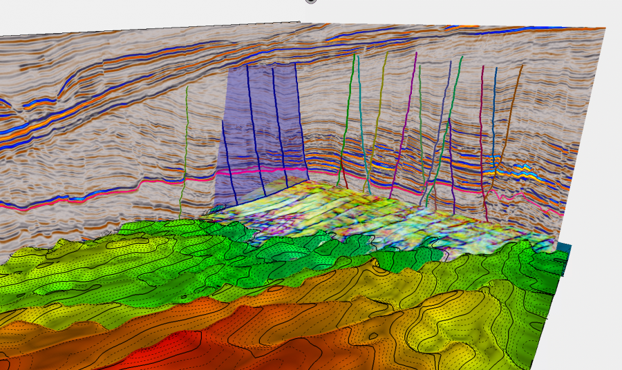
Our patented and uniquely powerful tools enable you to accurately interpret exactly what you see using a data-driven but interpreter guided approach. Being able to extract understanding from the data is the key to generating value. Geoteric is the only application to enable fuII horizon, fault and geobody interpretation directly on the structural and stratigraphic blends (RGB, CMY or HSV blends) that most effectively reveals the geology.

Being able to extract understanding from data is the key to generating value. Geoteric is the only application to enable full horizon, fault and geobody interpretation directly on the RGB, CMY or HSV blends that most effectively reveals the geology.
Adaptive interpretation tools for creating a regional or reservoir scale interpretations of the structure.
Our adaptive technology links the data to the interpreter providing the most likely pathway between the last picked point and the present location of the cursor. This suggestion, based on data analysis analytics, can be accepted or over-ridden by the interpreter. Working on both horizons and faults this adaptive interpretation dramatically speeds up the interpretation process saving time and money whilst delivering high quality results.
Ability to combine or divide geobodies easily
Accurate delineation of your reservoir body
Interactive geobody metric information
Tracks on multiple volumes simultaneously, including RGB blends
Manual manipulation of the geobody surface in 3D
Data-driven, interpreter-guided approach to geobody delineation
Definition of inclusion and exclusion zones
Horizon Interpretation using reflectivity data, attributes or HSV colour Blends
Harnesses the principles of cognitive decision making
Incorporates regional structural awareness
Interactive preview of all the alternate routes
Line picking and auto-tracking options
Interactive 3D editing of the surface
Fast, easy, and accurate
Interpretation of fault sticks and surfaces directly on the colour blends or individual attributes
Fault sticks can be picked in multiple orientations and on multiple volumes simultaneously
Fault surfaces can be used as visualisation planes and translated perpendicular to the fault
Polygons can be interpreted on any volume or colour blend
Vertical, horizontal or variable orientations (when picked on a horizon)
Full display controls for maximum impact
Now you’ve seen what Geoteric can do. It’s time to see Geoteric in action. Complete the form in order to transform your work, for smoother and more accurate interpretation and, ultimately, far better decision-making.
Don’t just take our word for it – see the impressive capabilities for yourself.