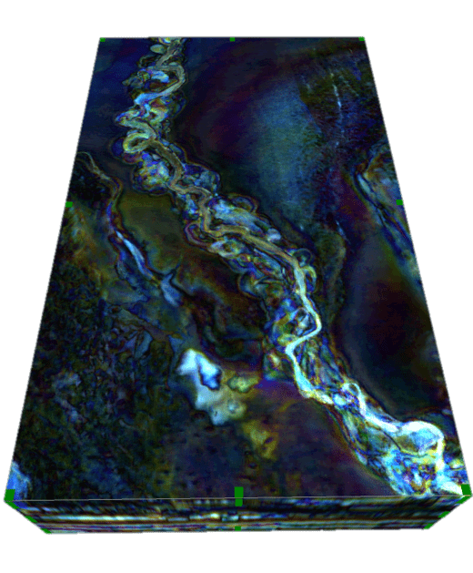
Reveal the geology in your data for a more insightful interpretation.
Geoteric’s Reveal module comprises a comprehensive suite of attributes and volume mathematics tools to allow you to “see” and understand the geology before you interpret.
Industry-leading techniques including high definition frequency decomposition combined with multi-attribute structural and stratigraphic analysis give a detailed geological understanding.

Stratigraphic analysis using frequency decomposition and RGB blending, iso-proportional slicing, to develop geologically meaningful attributes.
Structural analysis using fault delineation & CMY blending, dip azimuth and curvature.
High definition frequency decomposition (HDFD) using a modified matching pursuit algorithm
HDFD algorithm optimised for the complex waveform of broadband data
Interactive frequency analysis using constant bandwidth and constant scale filters
Integrated quantitative RGB blending as part of the frequency preview and selection process
Choice of techniques and parameters allows optimal results to be achieved in all situations
Trace spectrogram display
Fully volumetric output
Example driven fault imaging and extraction workflow displaying different options to guide your decisions
Three different discontinuity attributes sensitive to different aspects of the waveform
Integrated CMY blending with user-driven scale controls
Integrated Fault Detection on individual attributes and multi-attribute CMY Blends
Full control of the parameter options
Create iso-proportional or conformant surfaces to better visualise the geology
Analyse the data within each slice to create surface-based attributes
Interactive preview and iso-slice spacing control
Create horizon packs for interactive geological screening, conformant to structure
Over 50 different structural and stratigraphic attributes including single trace, multi trace and curvature-based attributes, as well as geobody delineation and analysis
Parser for simple volume maths and more sophisticated logical operations
Geology guided workflows for Carbonates, Channels, Salt and Faults
Now you’ve seen what Geoteric can do. It’s time to see Geoteric in action. Complete the form in order to transform your work, for smoother and more accurate interpretation and, ultimately, far better decision-making.
Don’t just take our word for it – see the impressive capabilities for yourself.