Can vintage seismic data be revitalised using Geoteric’s standard modules and our industry leading AI fault interpretation service? This is the question we asked and tested using a 1990’s vintage dataset from the GoM Shelf.
Data courtesy U.S. Bureau of Ocean Energy Management
Main Pass and Breton Sound Protraction Areas, U.S. Gulf of Mexico shelf
Age of faulting
Lower Cretaceous to Pliocene
Survey area
700km2/270 sq. mi.
Volume Size
10Gb
Rock Type
Predominantly clastic, Evaporites
Structural regime
Extensional
Onshore/Offshore
Offshore
Hydrocarbon type
Oil and Gas
The Main Pass Area is currently under brown field development and production, there is also associated infrastructure-led exploration. Given these circumstances, the need to extract new insightful information from existing datasets becomes ever more crucial for successful drilling and production campaigns.
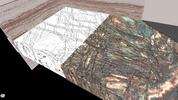
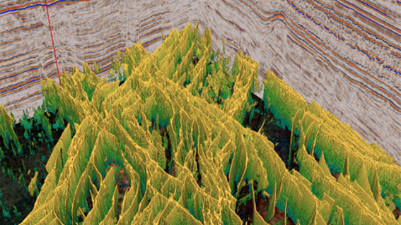
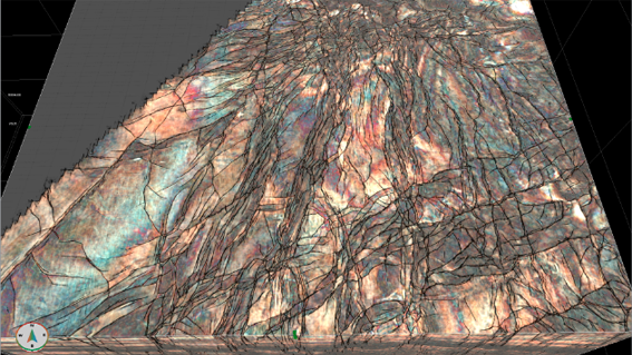
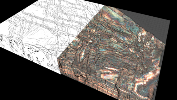
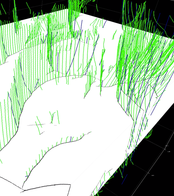
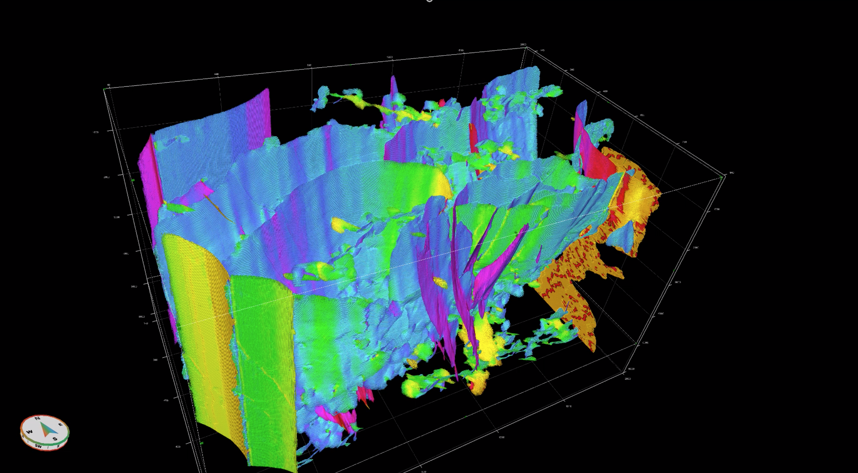
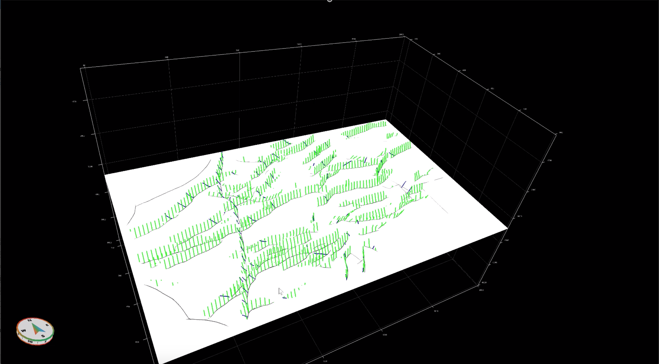
Within a matter of days, Geoteric's integrated workflow was used to condition the data, calculate standard structural and stratigraphic attributes, and run automated fault identification and picking using AI.
The interpreter proved absolutely essential to this process, as a small amount of expert interpretation can be used to 'fine-tune' the foundation network to significantly enhance the signature of delineated faults.
This effect was especially useful for fault identification in the deeper sections of the data where poor signal to noise ratio leads to an ambiguous response in the conventional structural attributes.
We believe there's a hidden story in every data set.
Read our case study to learn how Geoteric's cutting-edge AI technology can be used by interpreters to reveal the true geological story and unlock resources which may have been considered unattainable or undiscovered.
Project Imagery
Image Title
Image Title
Image Title
Title
slider-img-5
“Geoteric’s AI is the ultimate tool for fault identification and interpretation. Not only does the geoscientist gain remarkably detailed information in a short amount of time, but the ability to augment the model to ‘fine-tune’ to the specific dataset in question is what really gives the AI it’s power. Value can immediately be seen in data old and new through all phases of the exploration, development, and production cycle.”